

Hiking through the high desert of southeastern Utah is nothing like walking mountain trails in Colorado. That may sound obvious, but it took getting a little lost for me to truly understand the difference. And to gain a healthy respect for all the warnings to pack plenty of water when heading out for a hike in Canyonlands National Park.
I’d lost the trail before, back in the forested hills near Pagosa Springs, Colorado. There, I made a comforting discovery that even without cell service, your iPhone’s compass still works. In the woods, I just needed to retrace my steps, find the worn dirt path again, and make enough noise to avoid startling any mountain lions.
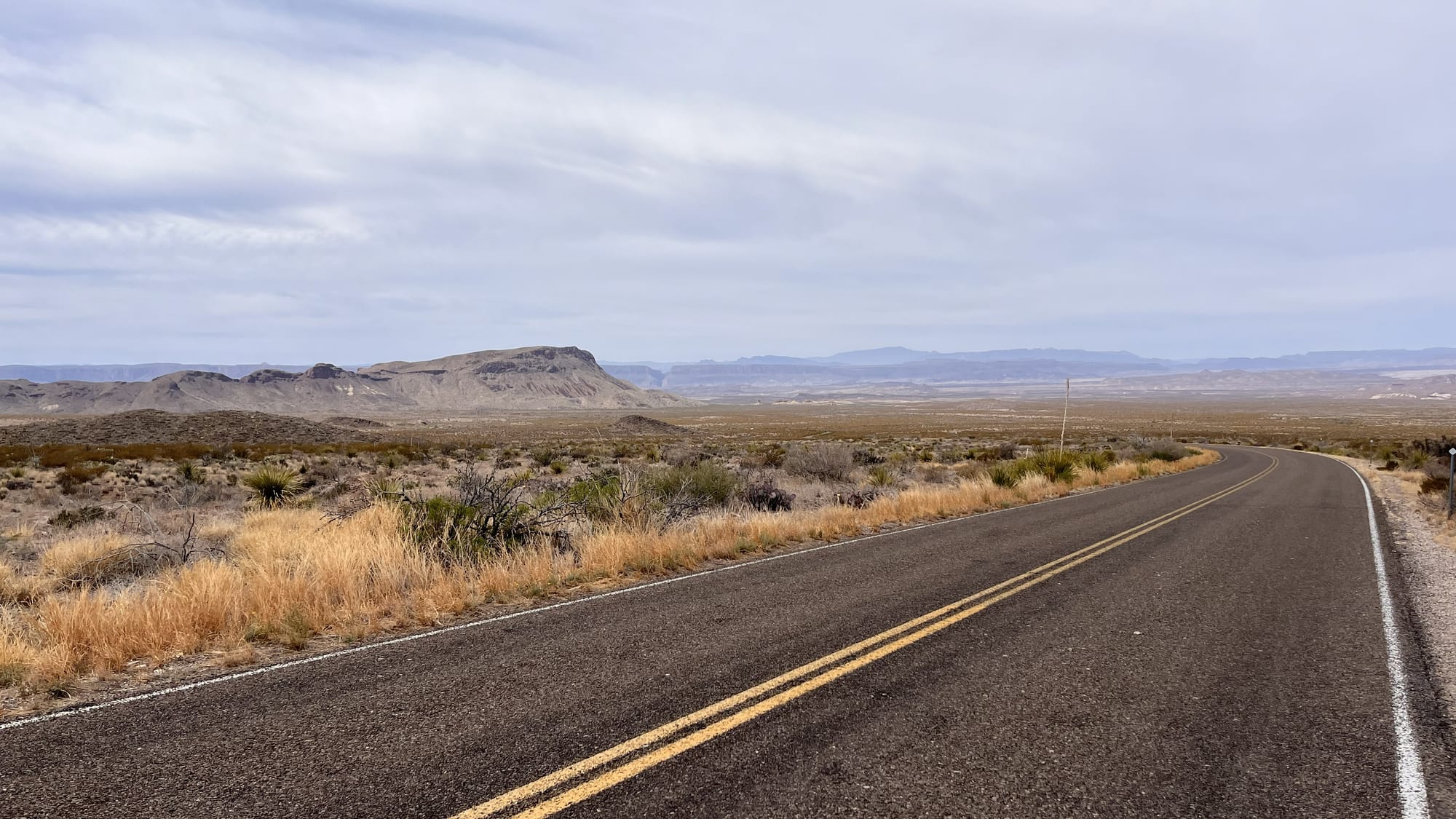
On the bare, smooth sandstone slickrock of southeastern Utah, there may not be an obvious trail worn down by the footsteps of others. Instead, trails are marked with cairns, small rock piles, but these markers are often spaced far apart and can blend into the scenery until you train your eyes to find them. (A quick plea: please don’t build your own rock piles for Instagram photos—you might lead someone off trail without realizing it.)
Utah was the second state I explored on my vagabond journey, and Canyonlands’ Needles District was my introduction to the wild beauty of its colorful canyons, mesas, buttes, fins, arches, and spires. Needles is one of four districts into which the 337,598 acres of Canyonlands are divided. Three of them intersect at the confluence of the Colorado and Green rivers, but traveling between them can take 2-6 hours by car due to limited river crossings.
Because I was based in the town of Moab for a couple of weeks, I could easily get to both Needles and the most-visited district, Island in the Sky, as well as other memorable stops along the way.
To reach Needles from Moab, you’ll drive south on Highway 191. You’ll know you’re close when you see Church Rock, a sandstone formation that reminded me of the Buddhist stupas I’d seen in Nepal. Despite the name, its story is more quirky than spiritual—local legend ties it to a 1930s utopian community led by a wandering mystic.
Turning off onto S.R. 211 takes you through Bears Ears National Monument, and in addition to leading to Needles, it brings you right by Newspaper Rock State Historic Monument. In Navajo, the rock is called "Tse' Hone'," which translates to "rock that tells a story." No one is really sure what the story is, though, because generations of Native peoples, including the Fremont, Ute, and Ancestral Puebloans (Anasazi), carved symbols here over many centuries.
Heading north from Moab will take you to the most accessible part of Canyonlands to visit if you have a short time, Island in the Sky. But if you’re not in a rush, you should stop at Dead Horse Point State Park on the way. The origin of its name goes back to a time when the point was used as a corral for wild mustangs roaming the mesa top, and is, unfortunately, as sad as you might imagine. But the desert plateau views from its rimrock trails will lift your spirits. Dogs on leash are also allowed on the trails in this park, so you can bring a cheerful companion with you.
Continuing into the Island in the Sky District brings more sweeping views of stereotypical canyon country. I started my day in Island in the Sky at the classic sunrise spot of Mesa Arch, and then headed to the panoramic views from the Grand View Point trail. Looking down at the winding Colorado River, the wide, dramatic vistas were a striking contrast to the ground-level navigation needed in the Needles District.
One thing both districts share, though, is that the trails are marked with cairns, and water is scarce.
I learned to take the National Park Service’s advice seriously. Always carry plenty of water, and bring a detailed topographic map. You can pick one up at the park store (along with a sticker or patch) and refill your water bottles while you're there. It’s a small step that can make all the difference when exploring Utah’s rugged, unforgettable terrain.
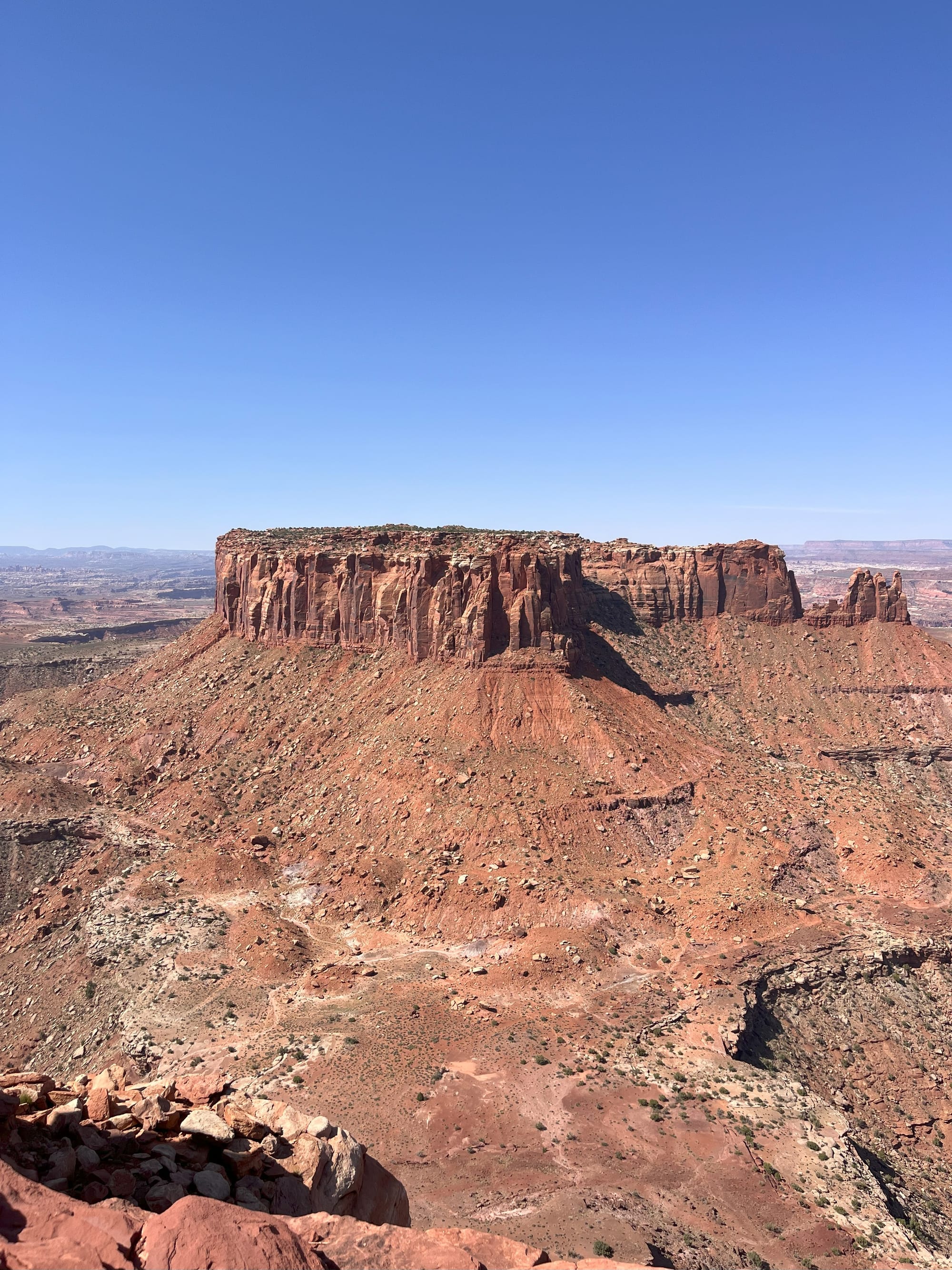
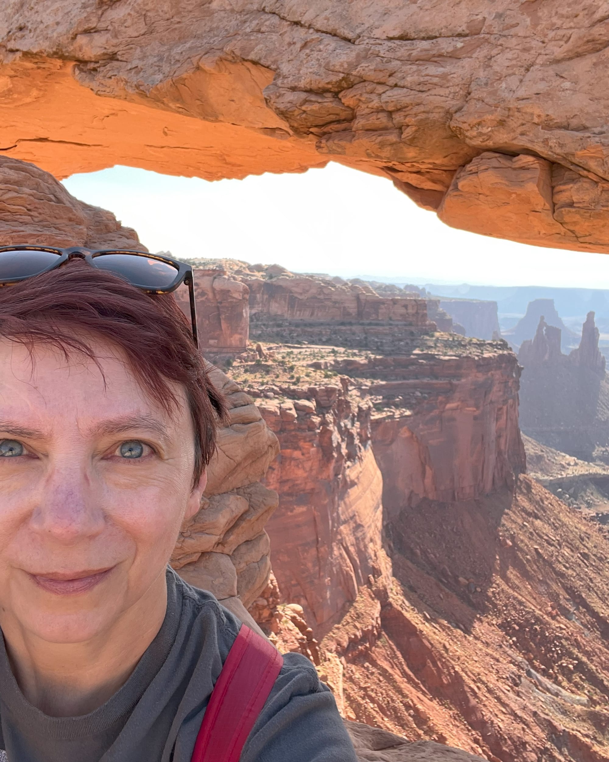
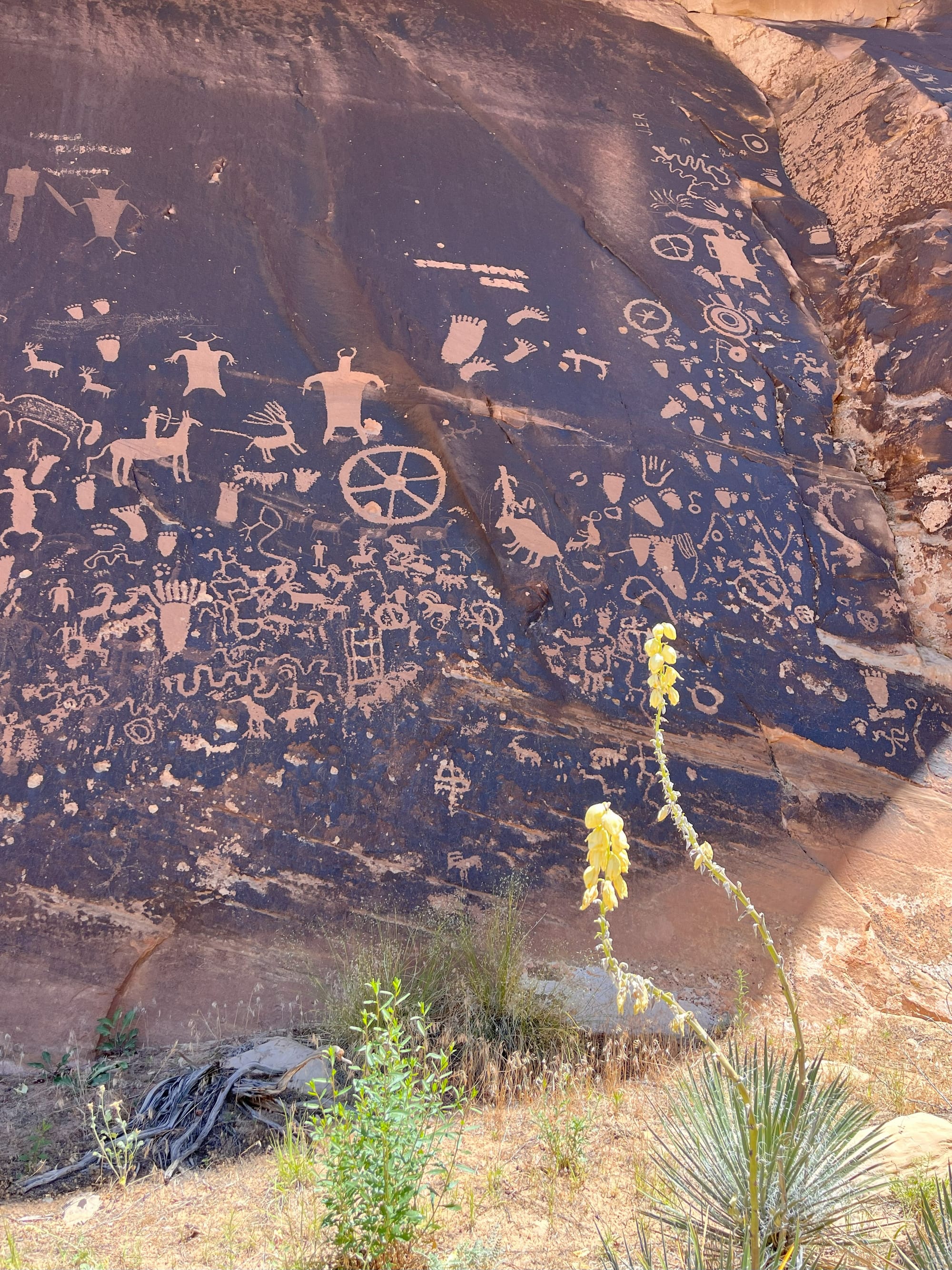
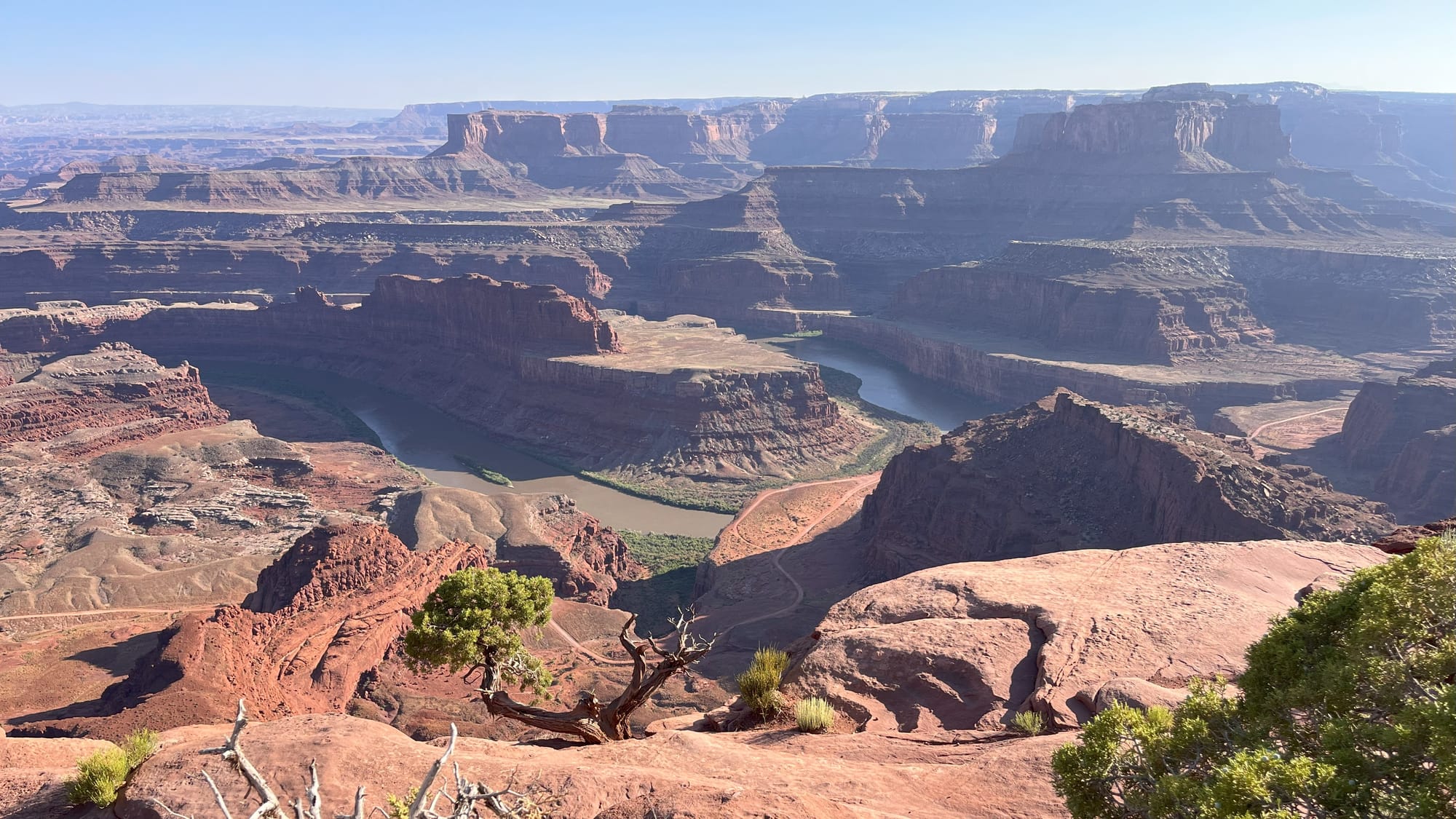
Clockwise: Island in the Sky, morning at Mesa Arch, Dead Horse Point, and Newspaper Rock © Laura Pevehouse
Comments