How to try to describe the Grand Canyon? Some use words like majestic, awe-inspiring, vast, iconic, profound, astonishing, and rugged. Spanish explorers in the 1500s called it an impassable barrier. I called it a challenge.
The Colorado River established its course approximately 6 million years ago, and the first evidence of human presence in the area dates back at least 10,500 years. Today, it averages 10 miles across and a mile deep along its 277-mile length, and much of the area is managed by the National Park Service. But the first time it really began to open up to tourists was when the Santa Fe Railroad completed a spur line to the South Rim in 1901.
That South Rim is still the primary way more than 4.7 million recreational visitors went to see the natural landmark in 2023, but as part of my vagabond journey, I decided to set a quest for myself to see the Grand Canyon from north, south, east, and west, and travel from its top rim to its river bottom. It takes a bit of research and planning, and a lot of time, which I had the privilege to have while working remotely for a month in Flagstaff, Arizona. My first step was to stop at the North Rim of Grand Canyon National Park when I departed Kanab, Utah.
Grand Canyon North Rim
Driving south on 89A, I left behind the summer heat of red rock landscapes and headed up into the lower temperatures of the Kaibab National Forest, part of the largest contiguous ponderosa pine forest in the United States. At a little town called Jacob Lake, I stopped for gas and then turned down Grand Canyon Highway toward the park.
There on the Kaibab Plateau, I had the fortune to see one of the few unfenced wild bison herds in the U.S. casually hanging out alongside the road. They’re cool to see, but they’re not native to the high-altitude forest, and the herd’s growth negatively impacts the ecosystem. So their size is primarily managed through transfers to American Indian tribes through an agreement with the Intertribal Buffalo Council.
The highway by which they grazed is the only way into the North Rim of Grand Canyon National Park, and it’s often closed due to snow and ice in the winter. So this portion of the Park is only open seasonally, May through October. But that’s not the only reason the North Rim receives a measly 10% of the Park’s total visitation. “As the crow flies,” it’s just 10 miles from the North Rim to the South Rim, but the drive between them is about 212 miles and takes around 4 ½ hours.
It took me about 2 ½ hours to drive the 74 miles from Kanab. These are not straight, fast Interstate roads. This is the scenic route. And it takes you to what some have called America’s best back porch view at the Grand Canyon Lodge.
Since this was a moving day for me, it meant that both my dog and my cat were along for the ride. Pets are allowed in the park, but not below the canyon rim, so our option for hiking was limited to a short walk to Bright Angel Point. And while at 8,000 feet elevation, the summer temperature was moderate, I didn’t want to leave my cat in the shade-parked car very long.
So, feeling like Clark Griswold, I snapped a few selfies and put the North Rim on my list of places I’d like to get back to someday, with the intention of renting one of the cozy cabins at the Lodge. Unfortunately, as I write this story, the Dragon Bravo Wildfire has severely damaged the Lodge and is still raging, causing the entire North Rim to be closed until further notice.
Grand Canyon South Rim
After settling into my Flagstaff accommodations, I set my next Grand Canyon course for the popular South Rim. It’s about an hour and 45 minutes drive to the park’s south entrance station that can be reached by turning north on Hwy 64 from Interstate 40.
The South Rim of Grand Canyon National Park offers many expansive viewpoints of the canyon and the Colorado River. These views are the primary images that come to mind when we think of the iconic landmark, and they’re why it is often crowded during the summer and school holiday times. The park is not currently requiring reservations or timed entry, like Arches National Park, but here’s another plug to get your America the Beautiful pass because it will get you through the entry lines quicker.
I left Flagstaff before sunrise in an attempt to get to the popular Bright Angel Trailhead before the summer heat and crowds, which helped me miss some of the entry traffic. But I wasn’t the only person on the trail early. There are lots of lodging options inside the park that enable visitors to wake up just a few steps from the canyon rim.
After going down and back up a stretch of Bright Angel Trail, I walked along the Canyon Rim Trail to Pima Point, where I was able to catch a shuttle bus and catch my breath while heading back to the Village. There, I had lunch at the El Tovar Hotel, which was built in 1905, and walked it off along the Trail of Time, which is an easy rim walk with a series of exhibits that explain the geology of how the Grand Canyon formed.
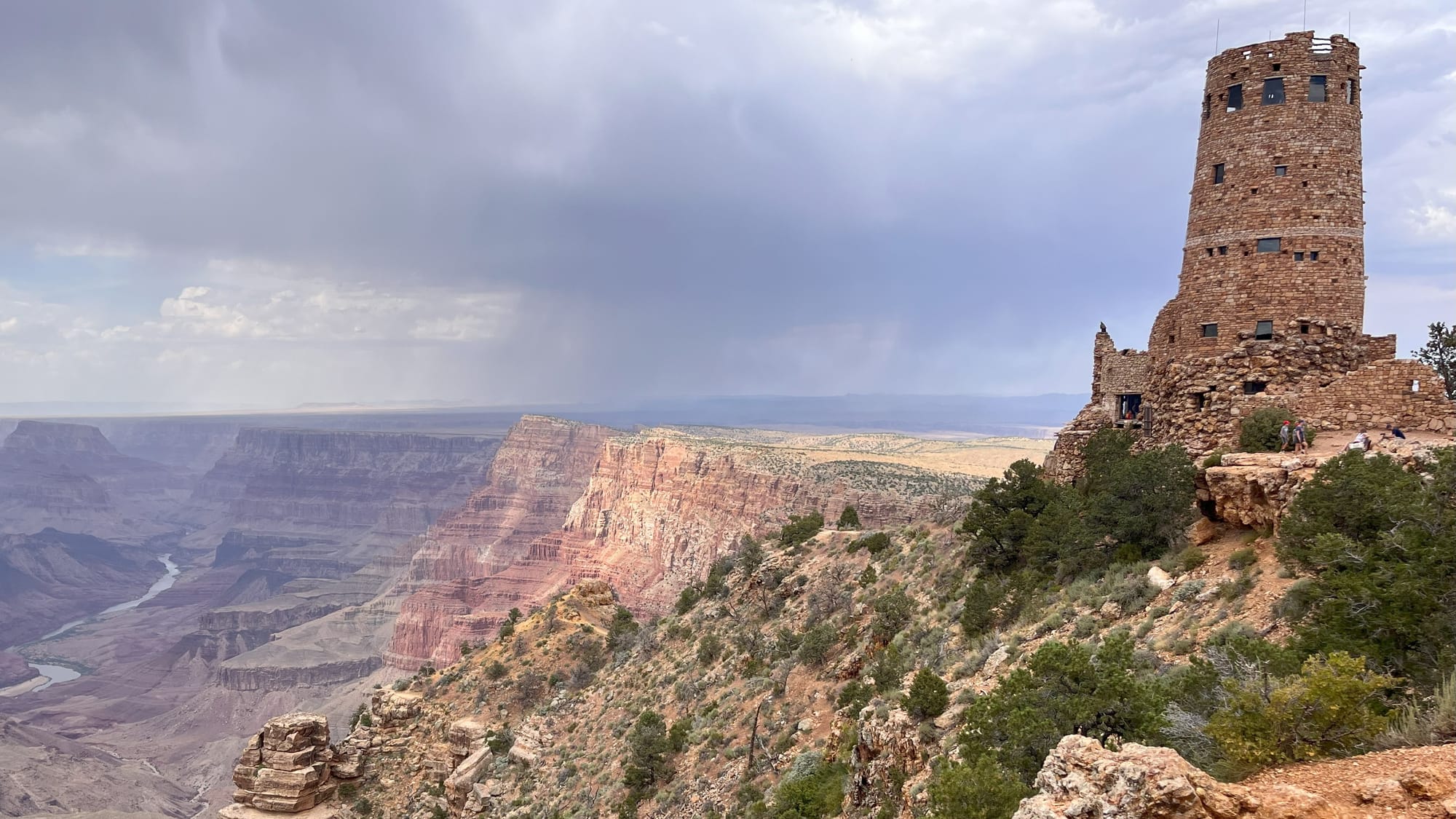
Then I returned to my car and headed out to Desert View Drive, the only scenic drive on the South Rim that is open to private vehicles all year. Along its 23 miles, you find several pullouts where you can park and take in panoramic views. This includes the Desert View Point and its historic Watchtower constructed in 1932, where I stopped just before reaching the East Entrance of the park, or in my case, the exit.
Grand Canyon East
Just outside that east entrance of the park, you find yourself on Navajoland. The Navajo Nation covers over 27,000 square miles, extending from northwest Arizona into the states of Utah and New Mexico.
And while there is no official definition of what is Grand Canyon East, for my goal of visiting all sides of the canyon, I counted my stop there at Little Colorado River Navajo Tribal Park as completing that part of my trek. This small park with a view of the deep, narrow gorge of the Little Colorado River is managed by the Navajo Nation Parks & Recreation program, which also manages the popular Antelope Canyon in Page, Arizona.
Some consider the area of Grand Canyon East to follow the Little Colorado River all the way up to Glen Canyon National Recreation Area. In which case, my day trip to visit its Insta-famous Horseshoe Bend also counts toward my goal of seeing the east side of the Grand Canyon.
Grand Canyon West
Grand Canyon West is a more well-defined area since the Hualapai (pronounced Wall-uh-pie) tribe officially established their tourism business in 1988. From a small dirt airport, it has grown to include several popular attractions such as the Grand Canyon Skywalk, a glass-bottomed walkway out over the edge of the canyon.
The Skywalk is a popular excursion for visitors in Las Vegas, Nevada, since it is an easy two-hour drive from Sin City. From where I was in Flagstaff, it would have been a 3 and ½ hour drive, but I’d already had multiple rim views of the canyon. What I now wanted was to look up from the river that carved it.
So I drove an hour and 45 minutes along the longest remaining stretch of historic Route 66 to the town of Peach Springs, inspiration for the Cars movie’s Radiator Springs. From there, the Hualapai River Runners offer day-long motorized whitewater rafting trips, as well as two-day paddling trips that include camping in the canyon. I chose the one-day option for $429, and spent two nights in the Hualapai Lodge, where I enjoyed a dinner of Hualapai stew and frybread.
The next morning, our group boarded an old school bus for an extremely bumpy ride down a dirt road to meet up with our river guides. I ended up at the front of our raft, which meant I was soon soaked by the rapids as I held on tight and squeezed my eyes shut to keep my contact lenses in. It was exhilarating!
We stopped once for a short hike up ropes and ladders to a cave with a waterfall, then continued downriver until time to stop for lunch, which the tour provided. We had time to cool off in the shallow water before moving on to the point where we met our bus again for a, thankfully, much smoother ride back to the lodge.
I was tired, but satisfied that I had reached my goal. There’s no way I could ever see ALL of the Grand Canyon. Beyond the 1,218,375 acres of the National Park, the portions on Navajo and Hualapai land, there’s also the 1,048,325-acre Grand Canyon–Parashant National Monument, the very remote and undeveloped west of the North Rim.
But I could say I’d done a pretty good job trying.


The author and her dog Jackson (RIP) at the North Rim, an expansive view from the South Rim, and a group of rafts on the Colorado River in Grand Canyon West. © Laura Pevehouse
Comments