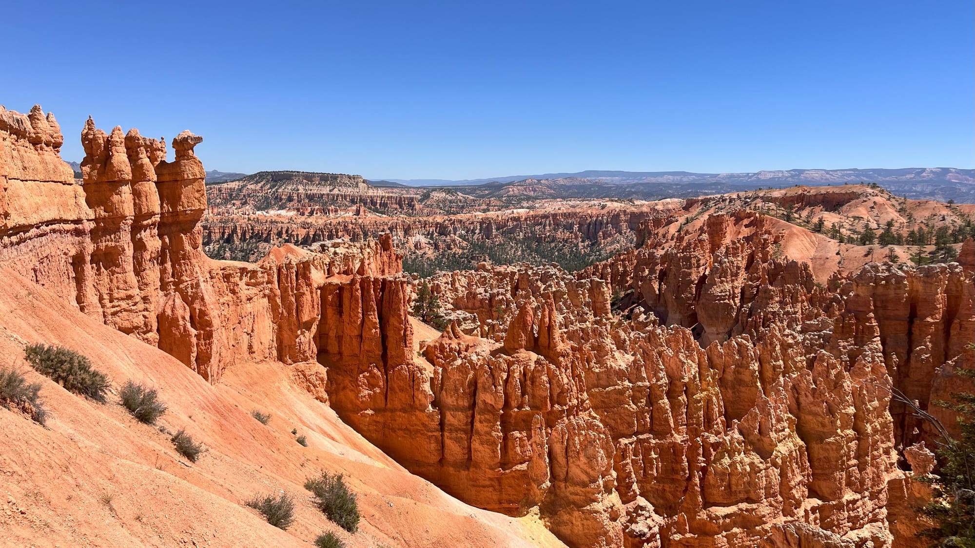
When people find out I visited 8 National Parks during my journey through Colorado, Utah, Arizona, and New Mexico, the first thing they most often do is ask which one was my favorite. It’s like asking a mother who their favorite child is. Each one offers unique natural beauty.
After facing the question so many times, though, I finally decided my simple answer would be Bryce Canyon National Park. It’s not the biggest National Park - only 56.2 square miles - but it packs in that space the largest concentration of hoodoos found on Earth. Their whimsical arrangements and multiple colors are amazing to see.
The reason I chose Bryce is not as simple as the views, though. It’s more about the sense of accomplishment I felt after completing my hike through what is not actually a canyon at all.
Bryce is a series of amphitheaters or "breaks" eroded into the eastern slope of the Paunsaugunt Plateau. It’s along this eastern side of the park that you find the most famous hoodoo rock formations and the major viewpoints such as Sunrise Point, Sunset Point, Inspiration Point, and Bryce Point. So it was there that I began looking for hiking trails on my (flat) map.
By now, I’d already learned a lot the hard way about the navigational difference in hiking in the green forested mountains of Colorado, the state, and traversing the arid rocky terrain of the Colorado Plateau in Utah. I’d experienced the difference between walking a mile at 10,000 feet elevation when the elevation only shifted 500 feet along the way, and walking a mile of switchbacks nearly 1,000 feet straight up. But I was about to find out what a difference choosing your starting and ending points can make for a one-way hike.
When you read about the Bryce Amphitheater Traverse route on the Park’s website, alongside important information like the distance of 4.7 miles, the elevation gain of 1,145 feet, and the designation as “strenuous,” there is a recommendation to start the one-way hike at Bryce Point.
But since I was starting this trek early in the morning, Sunrise Point just sounded like the place I wanted to begin.
I’d heard that parking can fill up quickly during peak summer season, which is when I was there, so I grabbed one of the first open spots I found near there. I also knew that during that busy time of year, the park runs a shuttle service that I could catch at the end of my hike at Bryce Point and ride back to my car in cool air conditioning.
So fresh and ready for the day, I headed out on the Queen’s Garden trail, where I dove into a bright orange sea of spires beneath a clear, brilliant blue sky. The two colors opposite on a color wheel complement each other from earth to space. This is the trail full of fanciful hoodoo formations that have been given names like Gulliver’s Castle and the Queen’s Castle. It’s almost always at the top of everyone’s list, you’ll find online for “best trails” in Bryce Canyon.
A close second, often combined with Queen’s Garden, is Navajo Loop, but I had noticed on my (flat) map that when you got near the intersection of the two, there was another trail called Peekaboo Loop that would lead me toward Bryce Point. With Queen's Garden + Navajo Loop clocking in at just 2.9 miles, it seemed a bit short for the sort of full-day hike I was seeking, so I decided to veer off that way.
Peekaboo Loop is a horse-friendly trail, and I did see a group of riders (probably one of these tours) not far from me, but I never actually crossed paths. And, I didn’t have to dodge a lot of manure like I did in Nepal, where the mules that bring supplies to the villages use the same trail as trekkers.
It was a good trail to be on in the afternoon, too, because there was also a nice bit of shade from the Ponderosa Pine, Bristlecone Pine, Colorado Pinyon, and Greenleaf Manzanita, which someone told me makes a tea that tastes similar to apple cider. As I emerged from the lower levels of the trail, I got my first view of my ultimate destination.
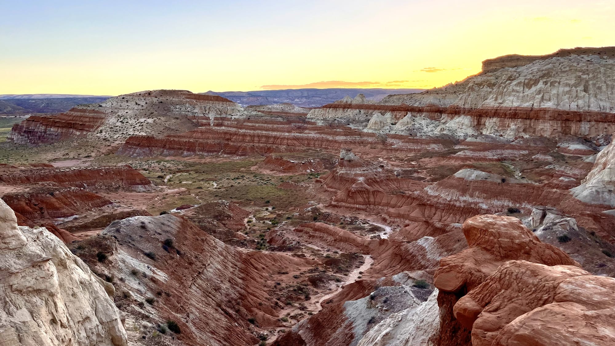
Six hundred and seventy feet doesn’t really sound like that much, right? But let me tell you, it looks like a lot when you’re three miles into your hike, looking up from the red, orange, and yellow lower half of the cliffs to the pure white limestone cap on Bryce Canyon's rim.
To put it into perspective, it’s like a 62-story building. So the specks I saw up on Bryce Point were people looking down from a height just eight stories lower than the Top of the Rock observation deck at Rockefeller Center in New York City. I couldn’t have been more than a grain of sand in their view.
I had missed the part where the NPS website suggested hikers start this trail descending from Bryce Point because the slope up to Sunrise Point is more gradual and therefore easier. But far be it from me to take the easy way, and I was too far in to turn back.
So while the views remained amazing, and I made frequent stops to catch them, and my breath, the rest of the hike was purely about perseverance. As I passed or was passed by others on the ascent, we all became each other’s cheerleaders. Everyone was checking that everyone else had sufficient water, and those descending shared encouraging words to tell us we were “almost there.”
When I finally reached the summit, the panoramic view of nature’s colorful canvas stretched before me took away what little breath I still had. Choosing the "wrong" direction had given me something the recommended route never could – it gave me a lesson on how sometimes the most rewarding paths are the ones we accidentally choose.
#NationalParkWeek


Comments