

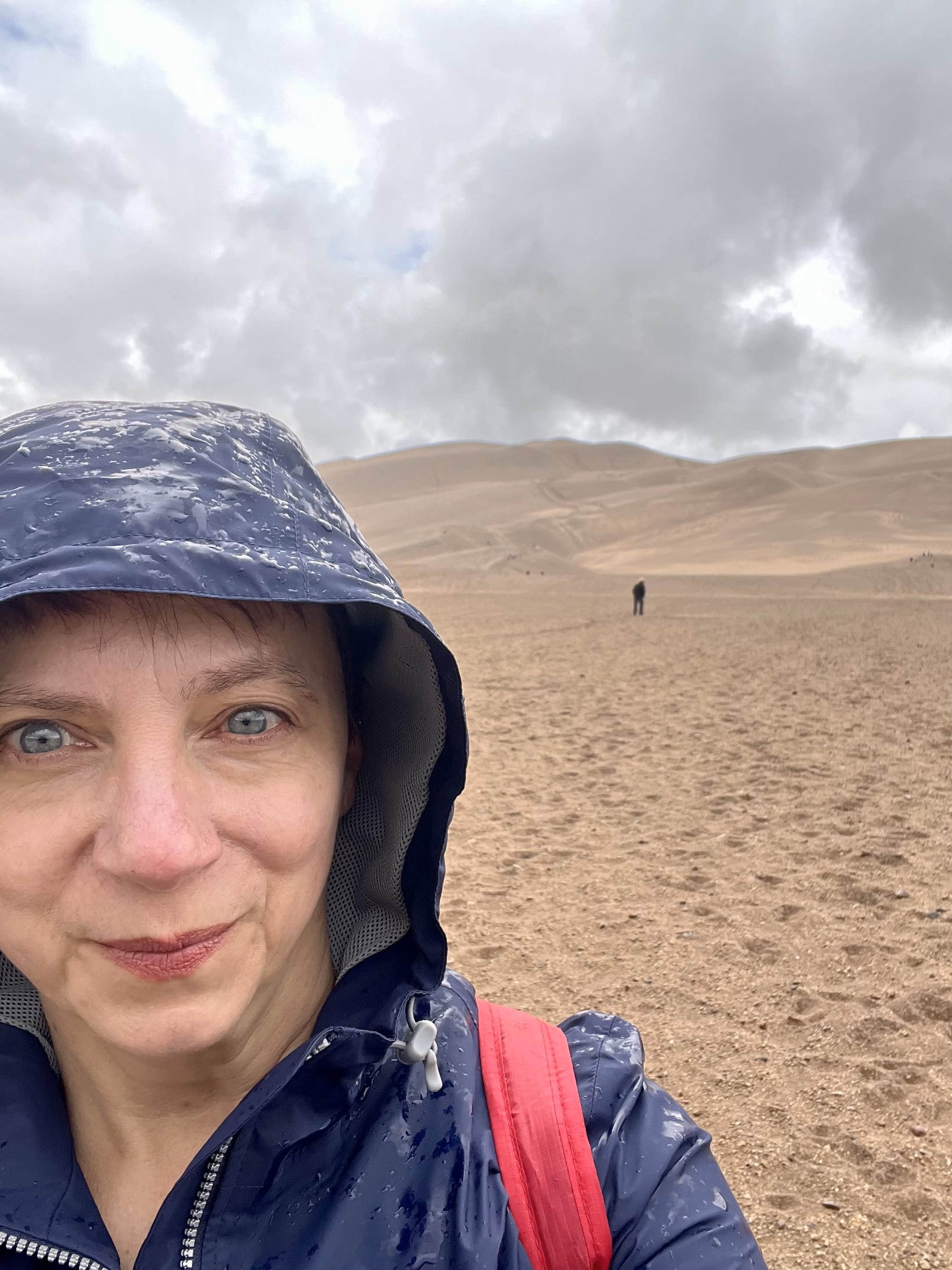
It was a shallow creek with a smooth, sandy bottom. Crossing it should have been easy enough to do without getting my feet wet on an unexpectedly chilly and rainy day in late May.
So I stepped out onto a high spot. But before I could decide on my next step, a wave of snow-melt-cold water crashed over the top of my hiking boots. I moved quickly to the next shallow area, only to see it suddenly turn ankle deep. So much for keeping my socks dry inside waterproof boots.
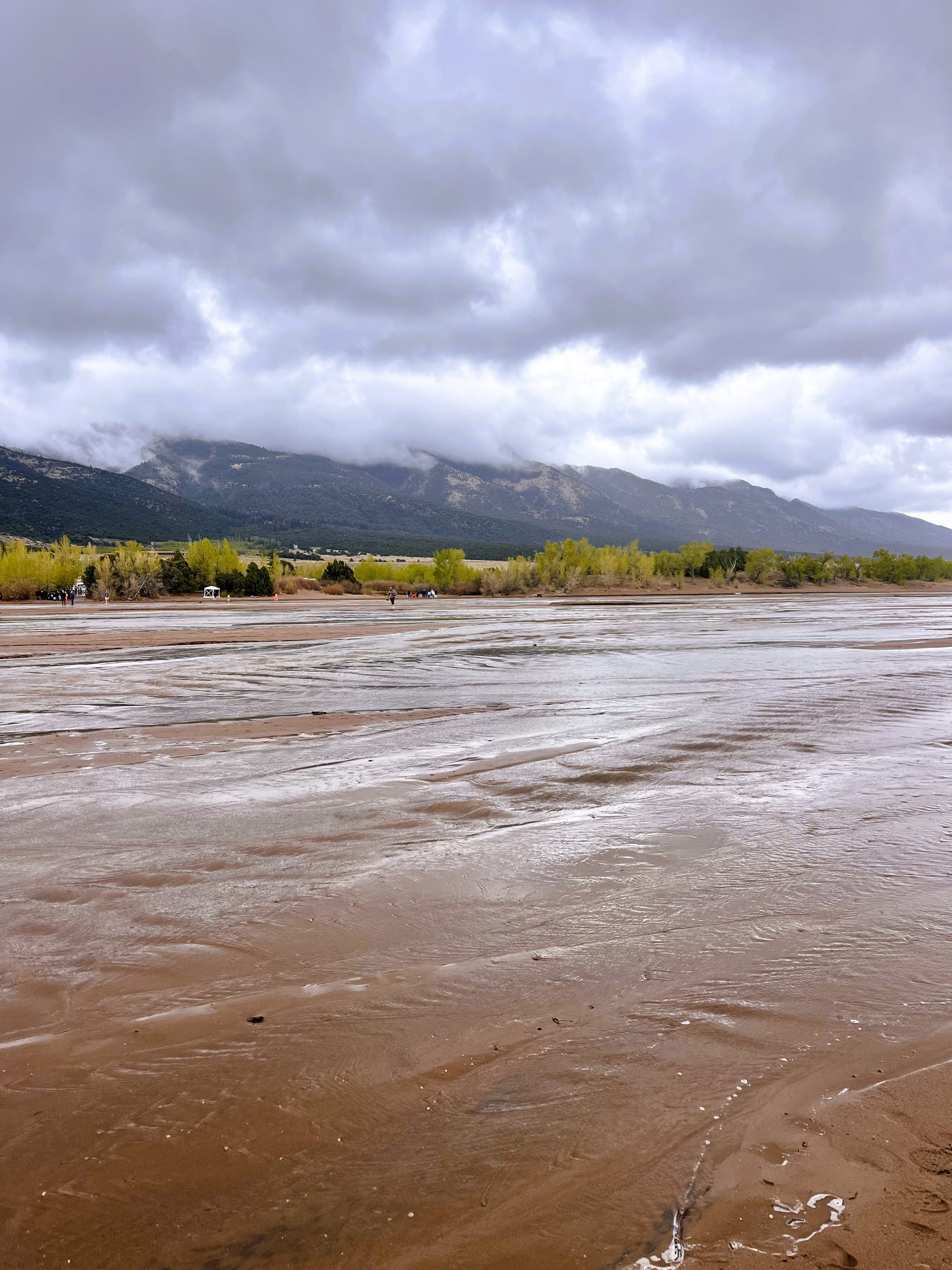
Waves in the ocean. Sure. Waves in a lake. If it’s large, yeah. But waves in a creek? I’d never heard of it.
It turns out that while it is rare, I’d found myself at one of two locations in the U.S. National Parks System where what is technically called surge flow happens. I’d come to see the tallest dunes in North America at Great Sand Dunes National Park in southern Colorado.
Nestled between the volcanically formed San Juan Mountains and the Sangre de Cristo Range, upfolded by tectonic movement, the San Luis Valley creates a unique combination of wind, water, and sediment for the formation of the Park’s namesake dunes. Creeks and streams brought in large amounts of sediment and sand into the valley. Wind then blew the sand toward the bend in the Sangre de Cristo Mountains, where opposing storm winds helped squeeze the sand into the tall dunes of today.
The sandy creek that I was crossing that day is named Medano Creek, which, if you were translating from Spanish to English, would aptly be Sand Dune Creek. When the snow melts off the top of the Sangre de Cristo Mountains, the creek becomes a popular place for families to picnic while kids float down the waves on inflatable toys. I’d unwittingly managed to time my visit for peak surge flow, late May to early June, which can bring waves as high as 20 inches in years of heavy snowfall.
But what actually creates the waves? The answer lies in hydrology and geography, and a fascinating interplay between water and sand that I'd never considered.
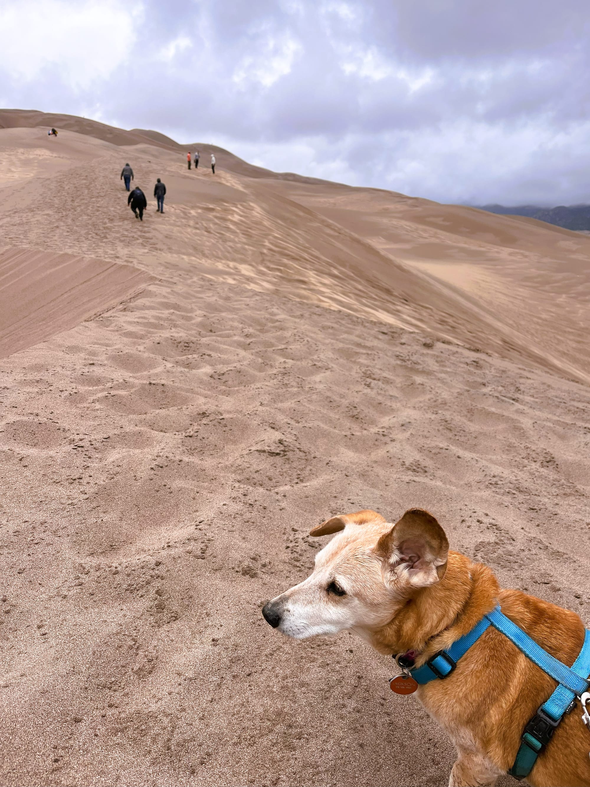
As water flows across the sand, underwater sand ridges called antidunes form on the creek bed, gathering water. When the water pressure is too great, the dams break, sending down a wave, or surge, about every 20 seconds. Which is how long I had to decide on each next step as I tried to hopscotch my way across with my 14-year-old dog in tow.
Yes, Great Sand Dunes Park is very dog-friendly. My little old guy only made it about three-quarters of the way up the dunes after we navigated the creek, but he still definitely earned the Bark Ranger Badge – a fun program where dogs get an official badge for visiting the park – that they had given me at the visitor center.
And if he had been up for more adventure, or perhaps if the weather that day had been better, we could have explored even more of the diverse ecosystem that the neighboring Great Sand Dunes National Preserve offers.
The famous dunes spread across 30 square miles of a unique high-altitude desert environment. Their surface can reach 150 degrees Fahrenheit on a summer afternoon (make sure they’re not too hot for your dog’s paws, or get them some protective booties) or drop to minus 20 degrees Fahrenheit on a winter night. Alternatively, there are a variety of trails to explore, from wetland areas to alpine tundra in the park and preserve. While the weather wasn't ideal for extensive hiking that day, I was curious about another water feature I'd heard about nearby. After checking out the creek and dunes, we decided to chase down Zapata Falls.
The Zapata Falls Recreational Area is approximately three miles south of the Great Sand Dunes National Park and Preserve entrance, and the view of the dunes is pretty great from its parking lot. Because it was a cool day, I was able to leave my dog in the car there while I ventured further up to find the waterfall, which is fed by snowmelt from the San Juan Mountains.
I had to plunge my already wet and cold feet into the creek and maneuver over slippery rocks to find Zapata’s hidden falls, but the sight when I got there was worth it. Back in my home base of Texas, the summer’s heat was already present, but there, at about 9,000 feet of elevation, I found a column of ice still encasing the cold water that was flowing down through it.
By this time, I’d worked up quite an appetite and headed back down to my car, where I wished I had thought to pack an extra pair of socks. Wet feet weren't comfortable, but they were also no issue when I found a nice pizza place in the nearby town of Alamosa that offered sidewalk seating.
As I sat there warming up and people-watching, Alamosa struck me as the kind of place with its own stories to tell, though I was eager to get back to dry shoes at my current vagabond outpost in Pagosa Springs. Alamosa was founded in 1878 when, they say, nearly 100 buildings were unloaded from rail cars in the span of one day. The Denver and Rio Grande Railway laid rails in all four directions, making Alamosa the hub of the San Luis Valley.
As I drove out of the Valley and back toward Pagosa Springs in the heart of the San Juan Mountain Range, the landscape slowly shifted from high desert back to mountain forest. Glancing in my rearview mirror at the massive dunes, I realized my soggy discomfort had been a small price to pay for a remarkable day in this part of Colorado. I'd encountered rare surge waves in a creek, witnessed a nearly frozen waterfall defying the coming spring warmth, and watched my loyal companion defy his own age to climb sand dunes and earn his Bark Ranger badge. The wet boots had become part of the adventure story, not something that detracted from it.
Comments