

Flagstaff, Arizona, is best known as a gateway to the Grand Canyon, but during the month I spent there, I discovered it is so much more. Out of all the places I visited during my vagabond days, it’s the one where I could most picture myself staying.
Flagstaff is located at the intersection of U.S. Interstate 40 and U.S. Interstate 17, at the base of the San Francisco Peaks, which include Arizona’s highest mountain, Humphreys Peak, at 12,633 feet. The city is a hub for outdoor activities, boasts a rich astronomical legacy, and makes a perfect jumping-off point to explore everything from wineries to meteor craters and national monuments.
Because of its high elevation, almost 7,000 feet above sea level, Flagstaff enjoys four full seasons. Still, I was delighted to be there mid-July to mid-August when the high temps were in the lower 80s as opposed to the triple-digit heat the southern part of Arizona is known for that time of year.
Road and Sky
The historic Route 66 paves its way straight through the heart of Flagstaff. It follows the same path as the railroad that helped build up the town’s livestock and lumber industries, as well as the merchants ready to serve the sheepherders, cowboys, lumberjacks, and train travelers. Several historic hotels and motels still line Route 66, and I saw more than one that appeared to have been updated to reflect the iconic 1950s-era design of the highway’s heyday.
Since I was traveling with my dog and cat, and planning to stay for several weeks, Airbnb was again my go-to option for lodging. The house I found had a cool, funky vibe, a front porch swing, and was near the Flagstaff Urban Trails System (FUTS, pronounced by locals as “foots”).
First envisioned in the late 1980s, FUTS has expanded from 3.2 miles to over 50 miles of scenic gravel, dirt, or sometimes paved pathways networked throughout the city. Designed for walkers, runners, and bicyclists, it continues to grow with a master plan for 75 more miles of future trails. It was nice to have paths near me where I could walk my dog through towering ponderosa pine trees.
Downtown Flagstaff is very walkable, as well, with lots of great shopping and dining options near the historic train station, where you can still catch an Amtrak, and stop in at the Visitor Center.
There on the north side of Route 66, I enjoyed great Mexican food and art at MartAnne’s Burrito Palace, and sushi and cocktails at Karma Sushi Bar & Grill. For evening entertainment, there were good pool tables at Collins Irish Pub, and late-night karaoke at The Monte V cocktail lounge below the historic (and supposedly haunted) Hotel Monte Vista. I was also introduced to poetry karaoke during poetry open mic nights at Flagstaff Brewing Company, where if you don’t have some of your own poetry to read, you're welcome to recite someone else’s. The bit of Shakespeare that I still remember from my sophomore year of high school finally came in handy!
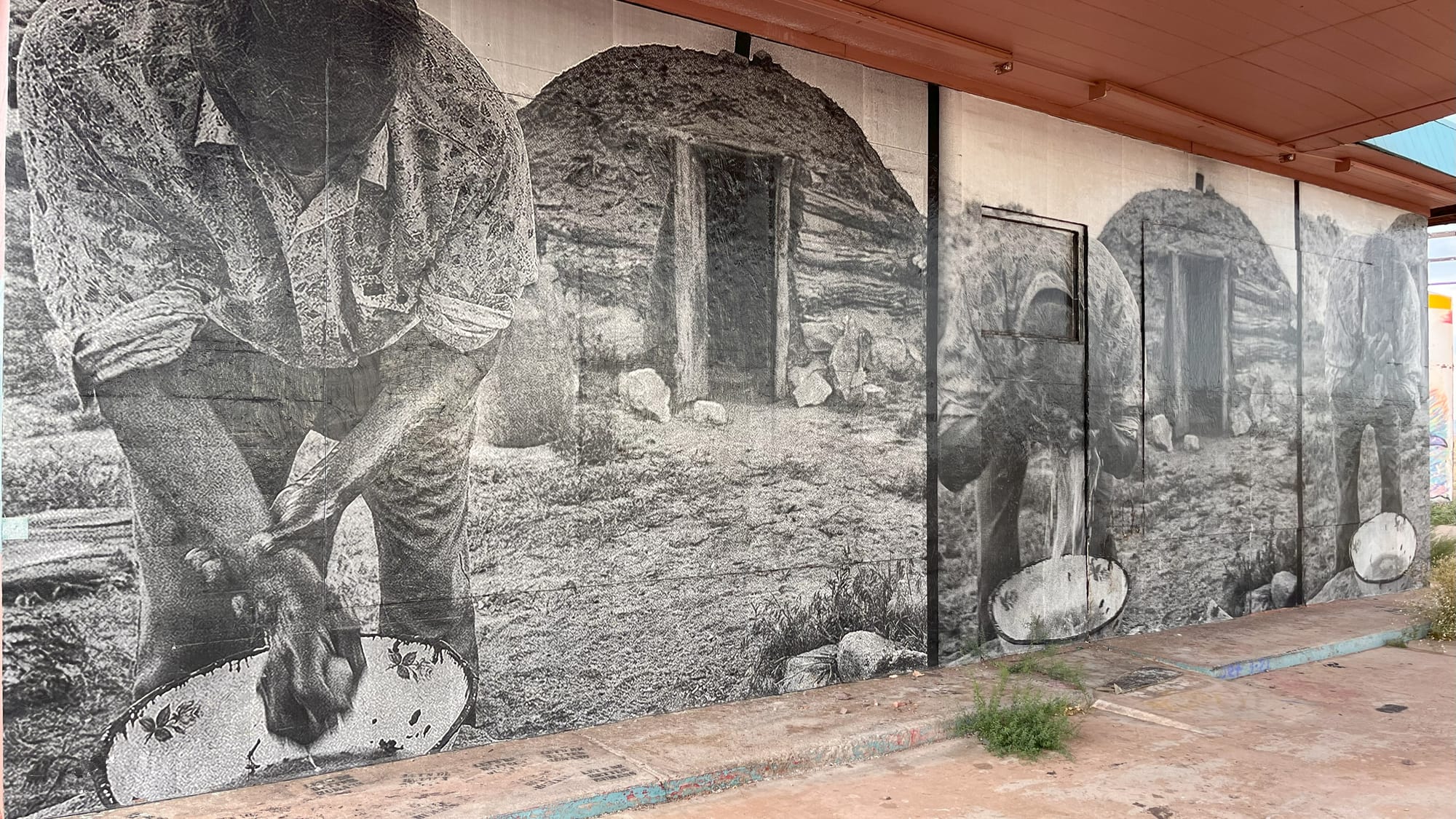
South of Route 66 and north of the Northern Arizona University campus, you find even more options in the historically diverse Southside neighborhood. I enjoyed sitting outside Macy’s European Coffeehouse & Bakery and getting some zen in at Northern Arizona Yoga Center. Also, behind Lumberyard Brewing Company, you’ll find a great mural depicting the history of Route 66.
Even older than that famous highway, though, is the Lowell Observatory that was established in Flagstaff in 1894 to study Mars and the possibility of life there. Instead, its major discovery came in 1930 when Pluto was found using the Lawrence Lowell Telescope. In the late 1950s, at the urging of the observatory’s scientists, the Flagstaff City Council created a lighting ordinance to protect against light pollution. In 2001, the city was named the world’s first International Dark Sky City.
I was fortunate to be in town during a Supermoon, and driving up Mars Hill toward the observatory, I found a great turnout where I stopped to watch it rise over the city. Then I went back another, darker, night to visit the Giovale Open Deck Observatory and gaze through its six advanced telescopes at the expanding universe around us.
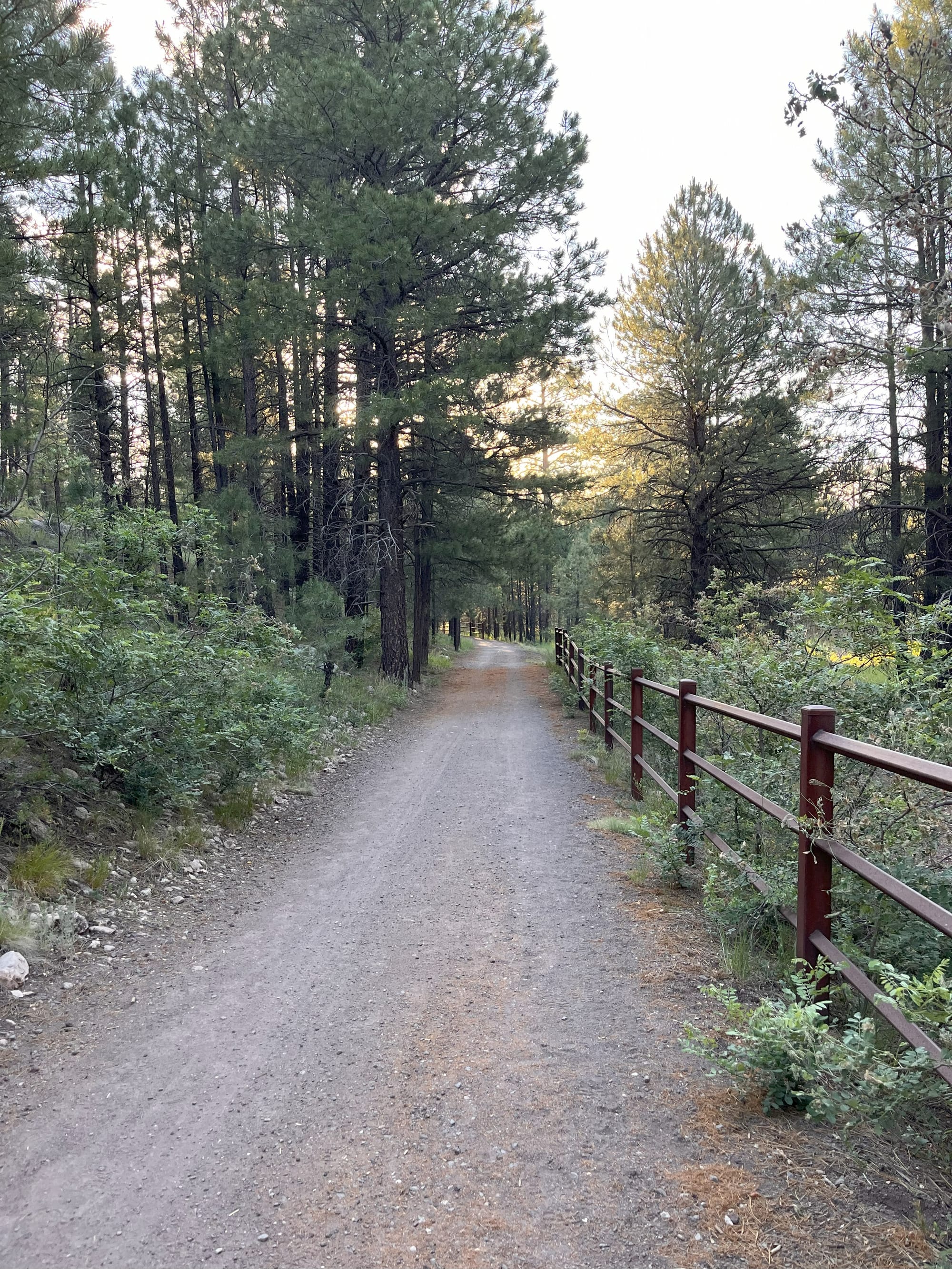
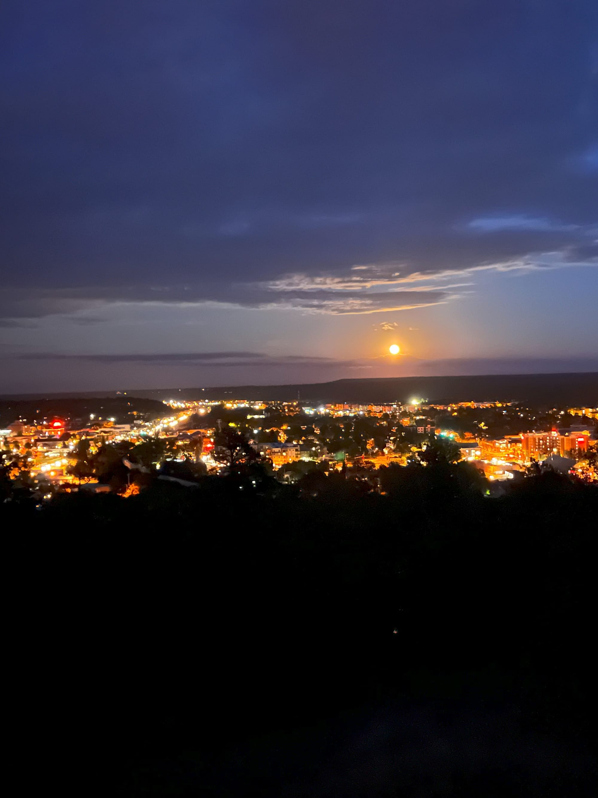
A section of the Flagstaff Urban Trails System, artwork at MartAnne’s Burrito Palace, and a supermoon rising over Route 66 in downtown Flagstaff, Arizona. © Laura Pevehouse
Natural Wonders
Flagstaff astronomers don’t limit themselves to Mars Hill, though. Every September, they gather along the trail of Buffalo Park to set up their personal telescopes and take advantage of the city’s dark skies in one of its most popular year-round outdoor spaces. Connected to FUTS and located on a mesa, its 2.2-mile paved loop was perfect for a sunset walk with my 15-year-old dog.
From the park, you can see Mount Elden, a dormant volcanic lava dome I was drawn to visit when I heard it had a trail called Fatmans Loop (yes, it's spelled Fatmans without an apostrophe). Supposedly an easy hike, it had a few steep, rocky sections that my old dog gave a big “nope” to, so our planned loop turned into a short up and down, meaning I didn’t get to see the trail’s namesake rock formation, which you have to make a tight squeeze through.
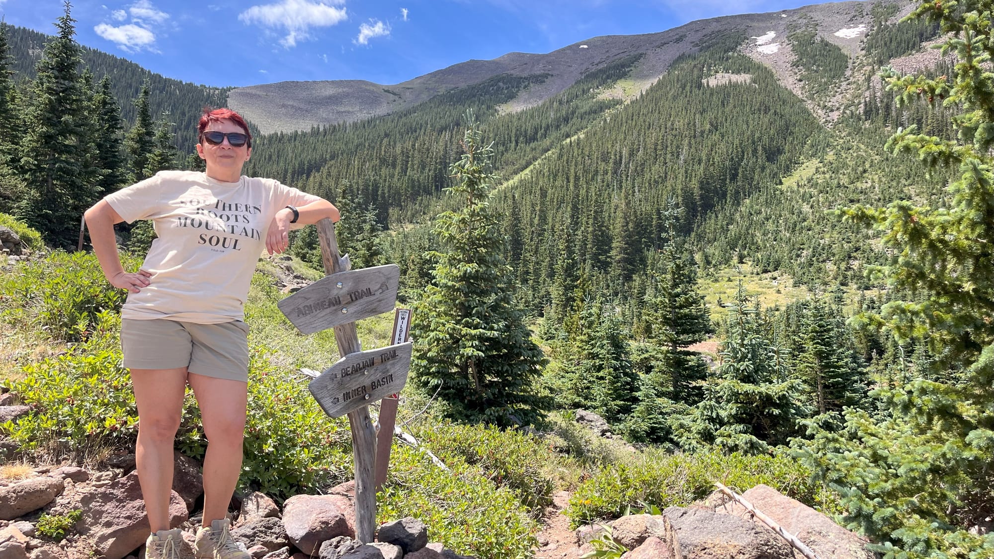
I definitely left my dog at home the day I joined a local companion on the Abineau/Bear Jaw Loop on the north side of the San Francisco Peaks. The maps said it was a strenuous 7-mile loop, but at the end, my Fitbit said 10 miles. That might be because we started off in the wrong direction and had to backtrack a bit. Either way, the elevation gain of 1,876 feet in the first two miles was tough. When we reached the top, he asked if the view was worth it, and it was great – you can see all the way to the edge of the Grand Canyon, 90 miles northwest. However, the greatest satisfaction came from pushing myself to do it.
I’m also glad I pushed myself to go back to a couple of places I’d seen when driving south into Flagstaff from Kanab, Utah, including an abandoned hotel in Gray Mountain. It’s been repurposed as a public art initiative called the Painted Desert Project with a mission to connect public artists with communities through mural opportunities on the Navajo Nation. But when I first passed its explosion of bright color along Hwy 89, I was nearing 80 miles per hour with a car close on my tail and couldn’t safely stop. The next time I was passing by on my return from the Grand Canyon South Rim, I was more prepared and could stop to take in the amazing large-scale artwork. So take this as my recommendation that you take the time to stop if you’re passing by, too.
It’s here that I once again also recommend that you get an America the Beautiful pass if you’re traveling around the U.S. In addition to Grand Canyon National Park, there are three National Park Service Monuments around Flagstaff, and more are easy day trips.
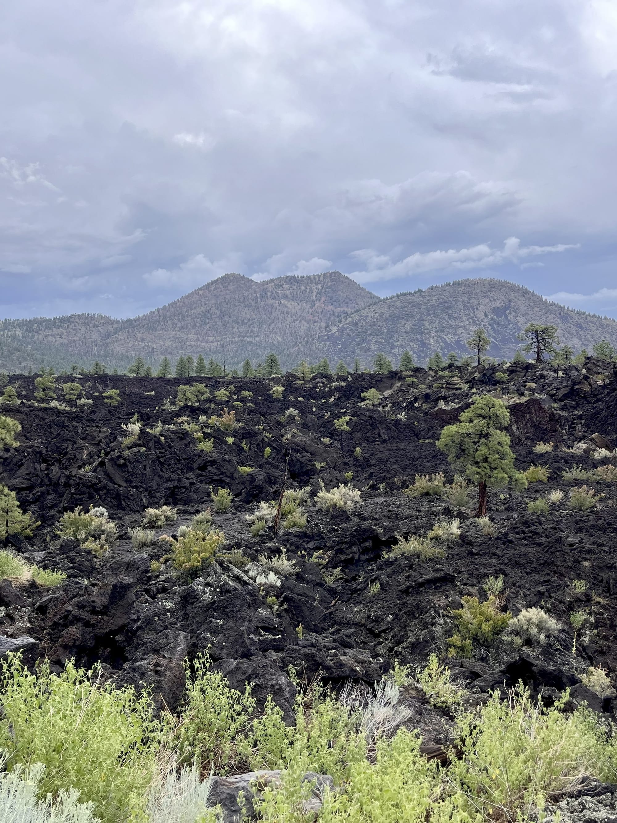
Two are such near neighbors to each other that I was able to see them both one evening after work. First, I went to Sunset Crater Volcano National Monument, which was not what I had expected. The crater was created around 1085 CE by a “curtain of fire” eruption similar to those that made the Hawaiian islands. You can understand why the astronauts who walked on the Moon trained here when you walk the jagged, black basalt rock of the Lava Flow trail. Backcountry hiking is not allowed in order to protect the park’s fragile geological features, as well as the landscape recovering from a major wildfire in 2022.
As I was returning to my car, clouds began to roll in, and on the short backroad drive over to Wupatki National Monument, I caught an amazing display of lightning across the desert. Unfortunately, it was a bit too close by the time I got to the Wukoki Pueblo, so I couldn’t safely walk around. I drove on toward the main entrance and stopped at the Citadel and Nalakihyu Pueblos, where I waited out the storm while eating the sandwich I’d packed. One other car was parked nearby, so I kept my doors locked and one eye on the stranger. But eventually the rain let up, and a double rainbow drew us both out. That’s when I met a very nice fellow solo traveler named Viola from Virginia who’d also been keeping a wary eye on me. Together we kept watch for more lightning while walking up to the Pueblo’s high point for some fantastic panoramic views and a post-thunderstorm sunset.
Before the Pueblos were built, Archaic peoples were already traveling the Flagstaff area and often visited what is now Walnut Canyon National Monument. At one point, some made homes in shallow alcoves along the canyon’s edges. I planned my visit there for Public Preservation Day and had the opportunity to give back a little by helping archaeologists and historic preservation workers repoint mortar on some of the 800-year-old cliff dwellings. I also learned that in the Hopi tradition, migration from one homesite to another is the fulfillment of a spiritual covenant, just one stop on a larger journey - meaning it doesn’t really matter why people moved on from living in this place, it was just one stop along the way to wherever they were meant to be.
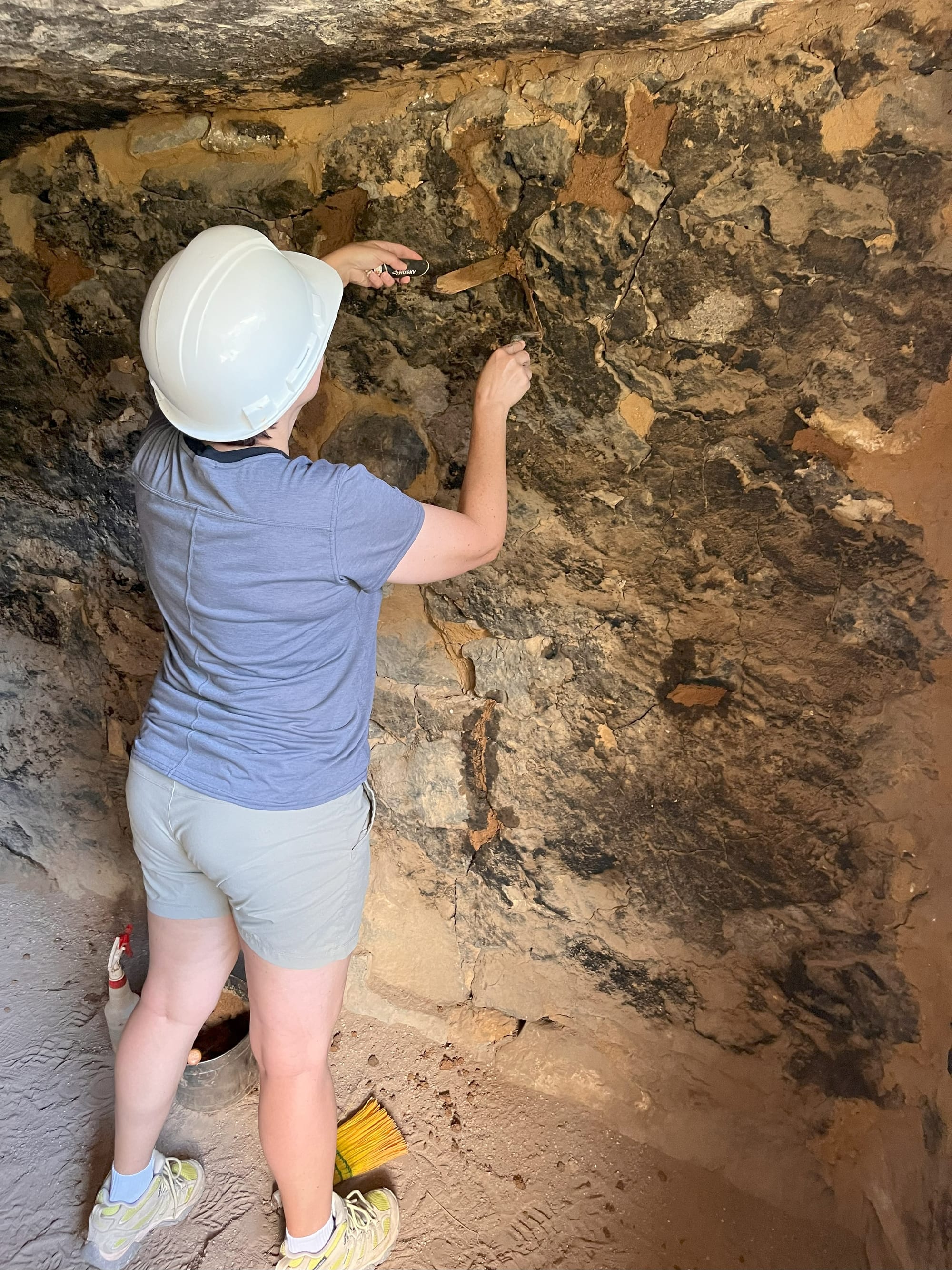
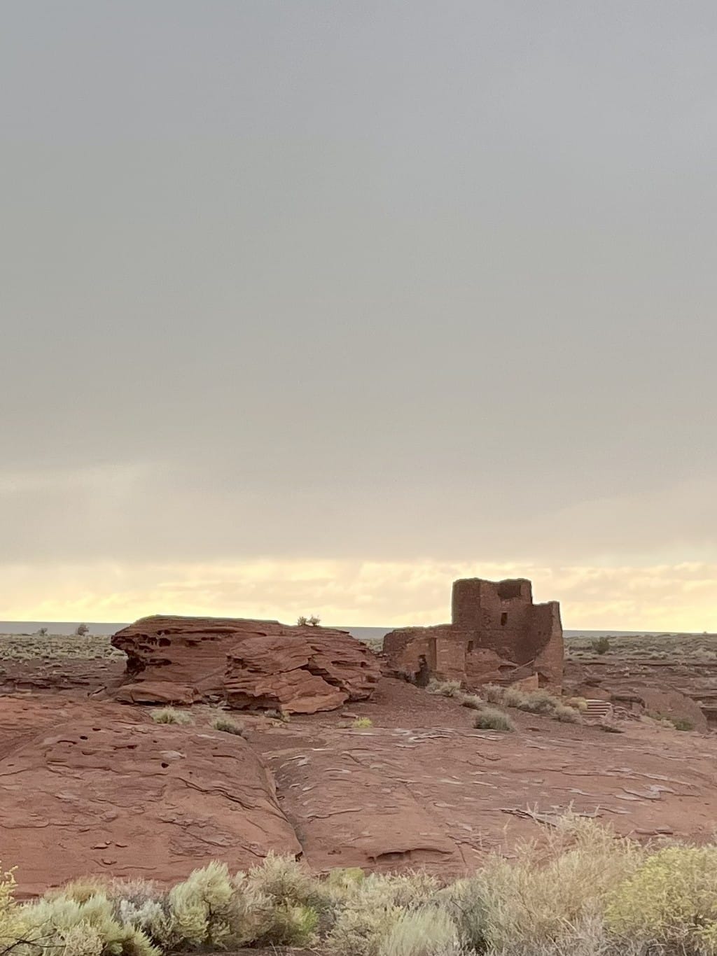
The Lava Flow at Sunset Crater National Monument, repointing mortar in cliff dwellings at Walnut Canyon National Monument, and Wukoki Pueblo at Wupatki National Monument. © Laura Pevehouse
Day Trips
And there are many stops you can add to your journey with easy day trips around Flagstaff. The Grand Canyon is one, of course. And probably the next most well-known is Sedona.
When driving from Flagstaff to Sedona, resist the temptation to get there faster on I-17 and instead take the scenic route on 89A. Pull over at the Oak Creek Vista for a great view of the mixture of red rock cliffs and lush greenery. Likely, there will also be Native American merchants selling their jewelry and art.
There are a ton of scenic hiking trails around Sedona, but the heat of the day kept my adventures in downtown where there are lots of cute shops and restaurants, and I couldn’t resist dipping a toe (well two feet) into the spiritual healing aspects the area is known for by stopping in for a foot massage that included crystals and ended with a card reading. It’s said there are several swirling centers of energy called vortexes in the red rocks there that naturally amplify meditation, healing, and self-discovery. Whether you believe in that or not, I can confirm that after all the hiking I’d done before coming to town, my feet left feeling nicely refreshed.
A little further down 89A, southwest of Sedona, you’ll find the little towns of Cottonwood and Jerome, which are in the heart of Arizona’s Verde Valley Wine Country. The surprising thread that connected these two for my visit is Maynard James Keenan, lead singer for the band Tool. I was surprised to learn he has several non-musical business ventures that revolve around winemaking in the area. At his Merkin Vinyards restaurant in Cottonwood, I had the best French Toast I think I’ve ever had because it was covered in fresh, local peaches. And in the wine tasting room in Jerome, I enjoyed a flight of his Caduceus Cellars reds, and picked up a t-shirt for his music project Puscifer at the record store next door.
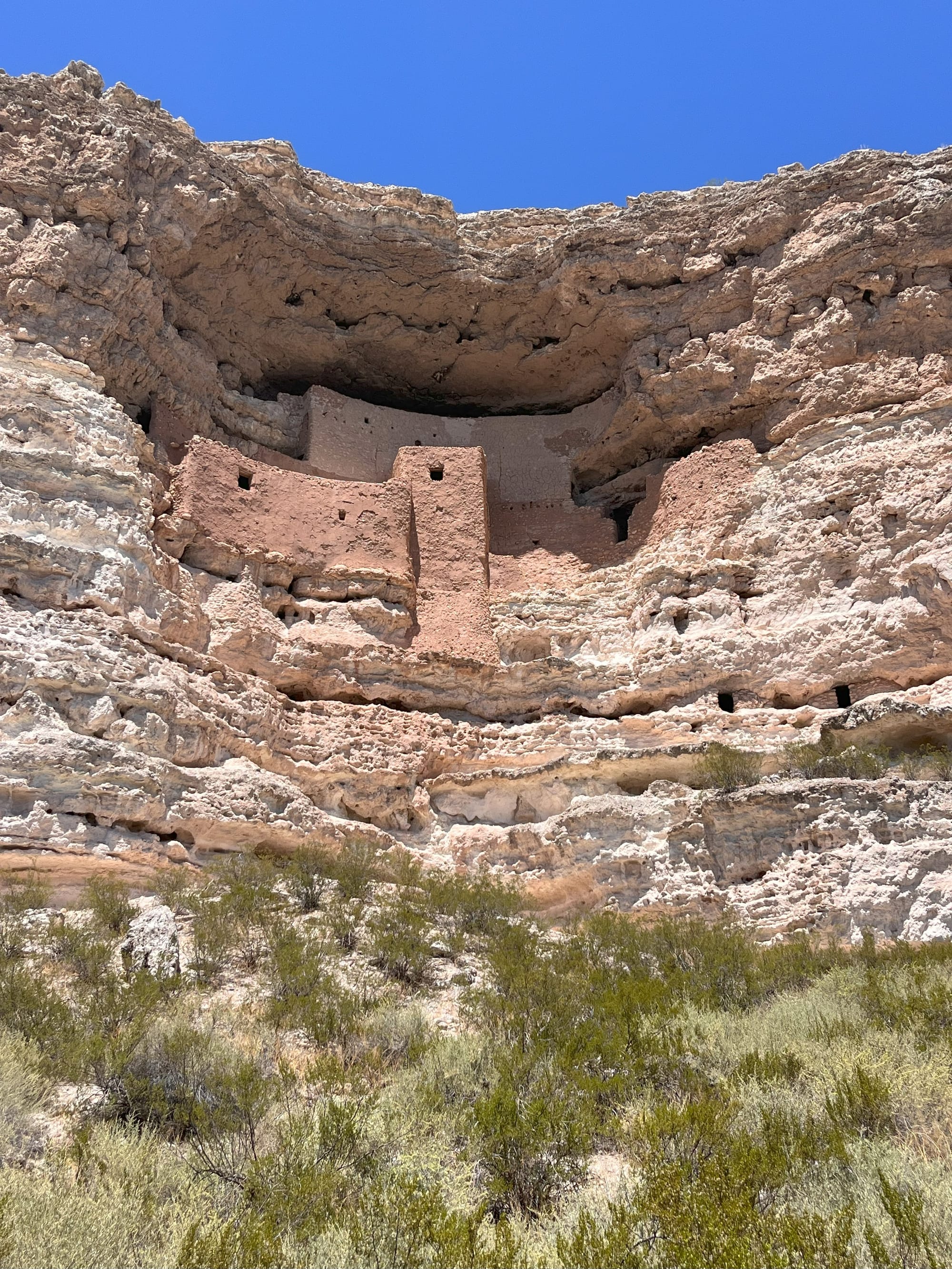
After walking off your food and beverages along either town’s cute main street, you can take the long way back to Flagstaff and mark another National Monument (or two) off your list. Nestled in a limestone cliff in Camp Verde, Arizona, is what is known as Montezuma Castle, although there’s no indication the Aztec ruler of that name ever stepped foot in the area. The Sinagua were the group of people who lived in the dwellings at Montezuma Castle and nearby Tuzigoot National Monument around 1050 CE. I didn’t squeeze Tuzigoot into my time in the Verde Valley, but Montezuma Castle was an easy on/off from I-17 and a short, easy walk to look up at the “castle” structure.
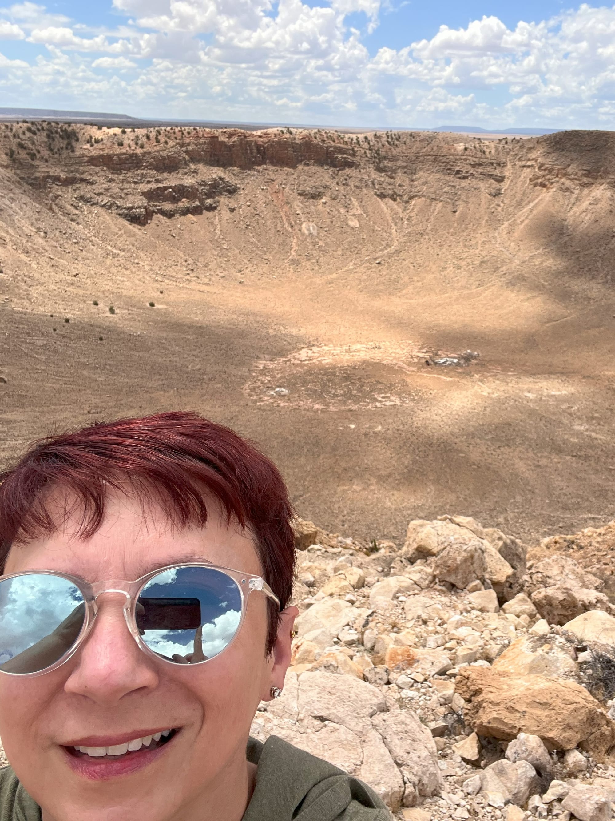
Another great day trip from Flagstaff will have you looking down on a hole that is still almost a mile wide and 550 feet deep, 50,000 years after it was formed. Meteor Crater is a classic Route 66 attraction and is one of the few remaining meteorite impact craters visible on Earth because of Arizona’s dry climate which has reduced its erosion. An important site for scientific research, similar to nearby Sunset Crater, it was also used to train Apollo astronauts and boasts an Apollo 11 training capsule in its museum.
A little further down Route 66/I-40 is the old railroad town of Winslow. It boasts the last-built of the famous Fred Harvey/Santa Fe Railway hotels, Las Posada, which is still open today. But the town really leans into its fame from the Eagles’ song “Take It Easy” and has created a park where you can photograph yourself “standing on a corner in Winslow, Arizona.” Although, Flagstaff folks will tell you that Jackson Browne originally wrote the lyric in their town. Winslow just seemed to flow a little more smoothly than Flagstaff when singing it, though.
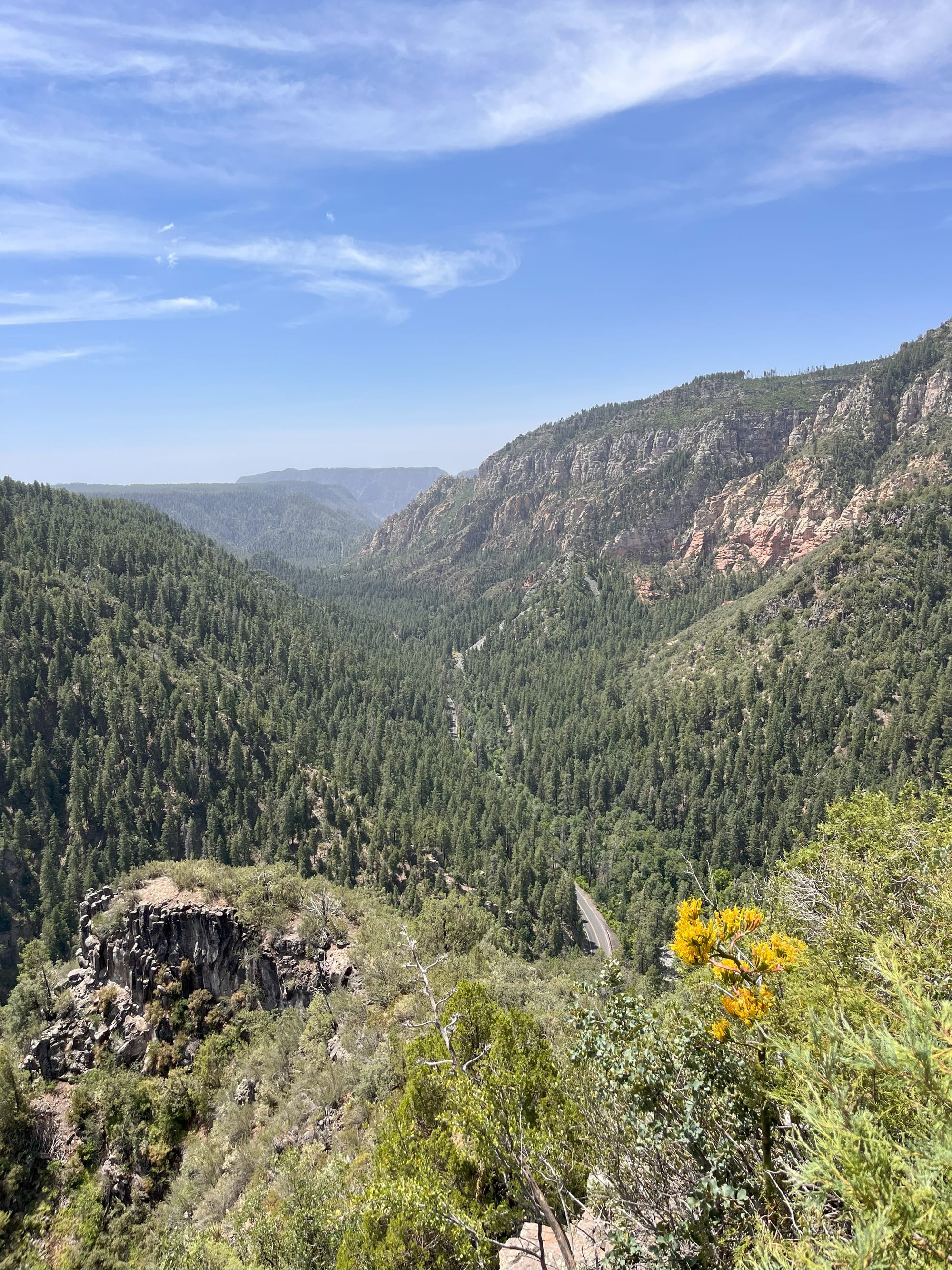
The view from Oak Creek Vista looking toward Sedona, Montezuma Castle National Monument, and Meteor Crater. © Laura Pevehouse
Driving back to Flagstaff, the three San Francisco Peaks really stand out before you. The green of the Coconino National Forest contrasts with the flat, brown landscape along the southern edge of the Navajo Nation. You can imagine they were a welcoming sight to the white settlers making their way toward California in the 1800s. It’s said that some of them used one of the forest’s Ponderosa Pine trees to raise an American flag on the Fourth of July, and that “flag staff” became a landmark for those who followed after them, as well as the town’s name.
Whether those early settlers could have imagined Flagstaff's transformation into an astronomical hub and outdoor paradise, I can't say. But I do know this: it offers something increasingly rare—a place where you can genuinely slow down, explore at your own pace, and discover that any traveler seeking a base camp combining small-town charm with big adventures will find themselves, like me, already planning their return visit before they've even left.
Comments